
Garmin
Garmin Navionics+ NSSA005L - Chile, Argentina Easter Island - Marine Chart [010-C1286-20]
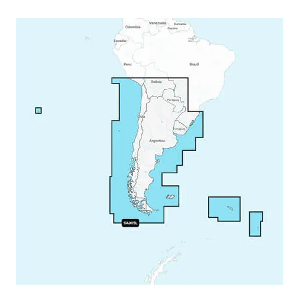
Navionics+™ NSSA005L - Chile, Argentina and Easter Island - Marine Chart Get the world’s No. 1 choice in the marine mapping with the best, most up-to-date Navionics®+ cartography on your compatible chartplotter. Featuring vibrant colors, a streamlined interface and combined coastal/inland content with a popular Navionics® style color palette, Garmin Navionics+ cartography makes it easy to plot your course. Multiple shading options aid in shallow water navigation and make it easy to highlight a target depth range for the best fishing spots. Fully customizable with various chart layers, overlay combinations and up to 10 color-shaded target depth ranges to scope out the best fishing spots. When you purchase a new Garmin Navionics+ or Garmin Navionics Vision+ cartography product, a one-year subscription is included. Chart Code - NSSA005L Coverage Area: Coastal coverage of South America from Arica, Chile to Rio Grande, Brazil. Coverage includes Easter Island, Cape Horn, the Falkland Islands/Islas Malvinas, the South Georgia Islands, the South Sandwich Islands and the Rio de la Plata. Features: All-in-one Map Solution - Access detail-rich mapping of coastal features, lakes, rivers and more. Integrated Garmin and Navionics® content offers coverage for boaters worldwide. Daily Chart Updates - Charts are constantly being enhanced with new and amended content — as many as 5,000 updates are made every day. The one-year included subscription gives you access to daily chart updates via the ActiveCaptain app. Auto Guidance+ Technology - Combining the best of Garmin and Navionics automatic routing features, built-in Auto Guidance+ technology1 gives you a suggested dock-to-dock path to follow through channels, inlets, marina entrances and more. Depth Range Shading - High-resolution...
- Ships from Mutiny Marine and Outdoors LLC
- Confirm fitment, size, and compatibility before purchase
Choose options